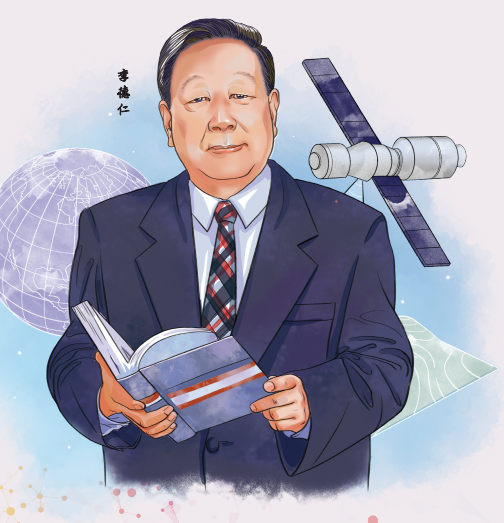
Li Deren, 83

Li Deren, 83 [Illustration by Yang Liu and Li Xiaotian]
A world-renowned scientist in photogrammetry and remote sensing. He is an academician of the Chinese Academy of Sciences and the Chinese Academy of Engineering, and an honorary member of the International Society for Photogrammetry and Remote Sensing.
Li, also a professor at Wuhan University, Hubei province, has won numerous prestigious awards, including the first prize of the 2020 State Scientific and Technological Progress Award and the ISPRS Brock Gold Medal Award for his outstanding contributions to photogrammetry. He has trained over 200 doctoral students, and is one of the key contributors that transformed China into a global geomatics powerhouse.
"Love my China, strengthen my country" is the first tenet of the family teachings passed down by the great grandfather of renowned geomatics and geospatial information scientist Li Deren.
Li said he is glad to have lived up to that motto. At the age of 83, he is still serving his country through his life-long passion of surveying and processing geographic information using satellites and other remote-sensing technologies.
Last year, Li and his team received the first prize of the 2020 State Scientific and Technological Progress Award for developing advanced Earth observation systems, which can swiftly provide high-definition images and information for applications including disaster relief, infrastructure construction and environmental protection.
The project took Li's team of nearly 100 experts a total of 15 years to complete. Now, Li is hoping to improve that system further and create more digital products that can help countries around the world achieve sustainable development.
"Science should serve the country, and geomatics is a discipline critical to national security and economic development," he said.
Collecting geographic data on nature and human activities helps experts and policymakers to arrive at informed decisions on sustainable development and other important needs, he added.
In March, Li and his team at the State Key Laboratory of Information Engineering in Surveying, Mapping and Remote Sensing at Wuhan University, Hubei province, published China's first global radar orthophoto.
An orthophoto is an aerial or satellite image without geometrical distortions, allowing scientists to measure the true distances of features within the photograph.
This makes an orthophoto a key tool for agriculture, resource management, urban planning and other industries.
Li said the map covers a land area of more than 200 million square kilometers, and the scientific data from the map are available for researchers around the world.
"We want to remove our reliance on foreign data, and pursue technological innovation to become more self-reliant," he said.
"The most important element of the scientific spirit is to seek truth from facts. We should respect science and scientists, but we can't place blind faith in existing teachings or foreign technologies."
"We have to make original breakthroughs that can solve the critical needs of the country," he added.


