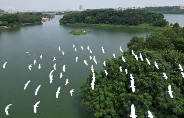
Baiyun unveils new ecological corridor plan
On Sept 4, Baiyun district of Guangzhou announced its new ecological corridor special plan on the website of the Guangzhou municipal planning and natural resources bureau.
This plan establishes a comprehensive ecological space framework, enhancing Baiyun's natural beauty and promoting harmonious urban-rural coexistence.
The plan outlines the creation of an ecological space network characterized by "one area, multiple corridors, five cores, and multiple nodes". The primary area, Maofeng Mountain Forest Ecological Area, is set to focus on preserving natural landscapes and advancing the construction of protected areas.
The corridors, including the Liuxi River and Baiyun River-Zhujiang West Channel, are expected to connect various urban and rural spaces, fostering ecological integration. The five core areas, Baiyun Lake, Baihaimian, Huangjinwei, Chenxiangsha, and Baiyun Mountain, serve as crucial nodes in the ecological network. These areas are set to provide accessible green spaces for recreation and nature appreciation.
The plan also introduces a four-zone control mechanism to ensure the effective implementation of the ecological corridors. The core zone is poised to prohibit new developments, encouraging the gradual restoration of existing structures.
The buffer zone outside urban development boundaries anticipates prioritizing green spaces and open areas, with strict regulations on new construction projects. The integration zone is set to control land use intensity, while the enhancement zone is expected to focus on improving existing ecological functions.

A view of the ecological corridor. [Photo/WeChat account: gz_baiyunfabu]


