Scenic hiking trail will wind throughout Fenghuang Mt
A necklace of waterside, mountain, urban, and coastal sceneries will be encountered along a 43-km (27-mile) H-shaped barrier-free trail proposed for Fenghuang Mt.
The conceptual design was announced at an executive meeting of the Zhuhai Municipal People's Government on June 10. It calls for a 5.2-km (3.2-mile) waterside section from Xiangshan Lake Park Phase III in New Xiangzhou to Dajingshan Community Park off East Meihua Road -- a 75-minute walk -- in the near term. Also planned is a one-hour cityscape section of 4.3 km (2.7 miles) from there to Sea & Sky (Haitian) Park in Old Xiangzhou.
Following that, a 3.1-km (1.9-mile) mountainous section will be opened from Haitian Park to Lishenqian Village in Tangjiawan -- 45 minutes to hike. Also coming is an 8.5-km (5.3-mile) coastal section from Lishenqian to Honghua Mt Forest Park in Yinkeng Village taking two hours to walk.

Overall design [Photo courtesy Guanhai App]
The hiking trail will, in the long run, traverse Sun Yat-sen University's Tianqin Space-based Gravitational Wave Research project, Beijing Normal University Zhuhai Campus, and Huitong Village in Tangjiawan, and connect to Zhongshan City's Wugui Mt.
It is to have unobstructed views of scenic spots along Fenghuang Mt and present neighboring residential communities with minimal landscape damage. Significant nodes will have vertical elevators for direct access to the trail.
The overall design highlights high-up views of Xiangshan Lake Park and Dajingshan Reservoir and two bridges that connect Dajingshan Community and Haitian parks. A 450-m (492-yd) suspension bridge will span Dajingshan park, which also will have spiral trails and vertical elevators, while a 120-m (131-yd) overpass will lead to the Haitian Park parking lot and Zhuhai Museum & Urban Planning Exhibition Hall on Central Lovers Avenue.
The trail is a key project of Zhuhai for 2020, with the government urging that preliminary work be done as soon as possible.
Covering 70 sq km (7,000 hectares) with a highest peak of 437 m (1,434 ft), Fenghuang Mt is the largest range in the city. It overlooks the sea to the east, abuts Zhongshan City in the west, borders Tangjiawan Town in the north, and fronts Zhuhai downtown areas in the south. The natural landmark encompasses at least 15 hills over 150 m (492 ft) in altitude. It also feeds Zhuhai, Dajingshan, Meixi, Zhengkeng, and Youth reservoirs with streams and brooks.
Join in
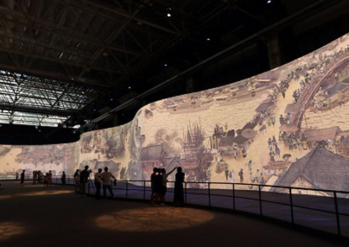 Moving 'Qingming Festival by the Riverside' on exhibition in Zhuhai
Piquing Interest
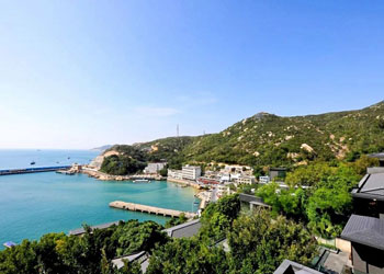 Zhuhai islands aim high in tourism
Living Here
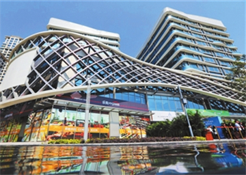 Hong Kong-Macao residents guided into living in Zhuhai