 中文PortuguêsEspañolContact Us
Zhuhai Orbita Control Engineering, which last June launched two video micro-satellites it had designed and provided components for, will send ten more into space this year and another 22 in 2019.
Last year's accomplishment was China's first independent operation of a satellite constellation (Zhuhai One) by a private enterprise and prelude to construction of Zhuhai Satellite Data Industry Park and Satellite Data Industry Incubation Center in Tangjiawan.
The satellite remote-sensing data better monitors and protects land, forest, water, and other resources. A press release from Orbita partner OCE Technology stated that: "The Zhuhai One remote-sensing micro-satellite constellation consists of 34 different satellites, a combination of hyperspectral and radar satellites in different orbits covering the whole world. The satellites have a full range of remote sensing, all-weather, high temporal resolution, and high spatial resolution."

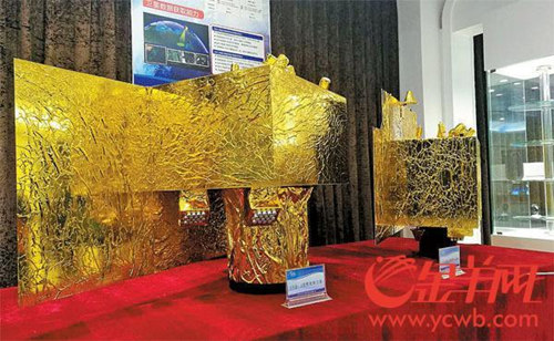
Prototypes of a second-generation video (L) and a hyperspectral micro-nano satellites (R)
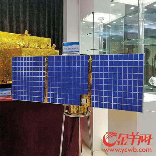
Last June, the first two satellites -- OVS-1A and IVS-1B -- were launched from Jiuquan Satellite Launch Center in the Inner Mongolia Autonomous Region, aboard a Long March 4B (CZ-4B/Y31) rocket. Fitted with an all-weather video system reaching ground resolution of 1.98 m, the satellites circle the planet 15 times a day while capturing up to 20 frames per second.
A second-generation video for qualitative observation and four hyperspectral micro-nano satellites for quantitative analysis are to enter orbit in March. Video satellites recognize water while hyperspectral ones can deliver information about the water, such as to what extent it is polluted. Likewise, analysis can decide whether farmland is being affected by pests and diseases. This is due partly to a higher resolution -- 0.9 m -- according to Jiang Xiaohua, chairman of the board and executive vice general manager of the company.

Model of last year's video satellite
The plan is to launch the next five satellites in July or August.
When in place, these widespread satellites can globally collect massive remote-sensing data including visible light images, videos, hyperspectral images, and synthetic-aperture radar (SAR) images.
The primary data, after being received and processed at the ground operation center in Zhuhai, will contain high value-added information. By then, the effective use of this data from space will benefit the development of land, forestry, water, marine, agriculture, housing construction, planning, transportation, meteorology, environmental protection, and other fields.

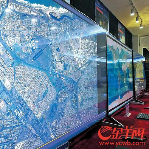
Clear images sent by Zhuhai-1 satellites launched last year [Photos courtesy ycwb.com]